
Powerful Point Cloud Meshing Tool for 3D Scanners and UAVs
GeoMine CloudMesher (CloudMesher) is a powerful point cloud meshing tool for 3D scanners and UAVs. Large point clouds with tens of millions of points can be viewed in an interactive speed on commodity laptops. Several meshing tools are included for creating high quality surfaces or solids that honour the original point clouds and that can be subsequently used as actionable mining objects for downstream design purposes, such as pit or stope reconciliations, cross sectioning, summarization of underdig, overdig, and percentage of volume variance.
CloudMesher Key Benefits
- Extendable: Takes point clouds as input directly from 3D LiDAR scanners, robotics, drones, and geotechnical monitoring systems.
- User-friendly: Seamless workflow makes processing scan data quick and easy
- Integrated: Works seamlessly with all other modules in GeoMine to turn point clouds into actionable mining CAD objects
CloudMesher Feature List
Interactive viewing and mark-ups
Interactively view, mark-up and measure large point clouds.
Point Cloud Processing Tools
Tool for interactively deleting individual points of a point cloud within a freehand drawing region
Tools for filtering and trimming point clouds
Tool for splitting a single point cloud into sections with a few mouse clicks
Tools for performing Boolean operations on point clouds.
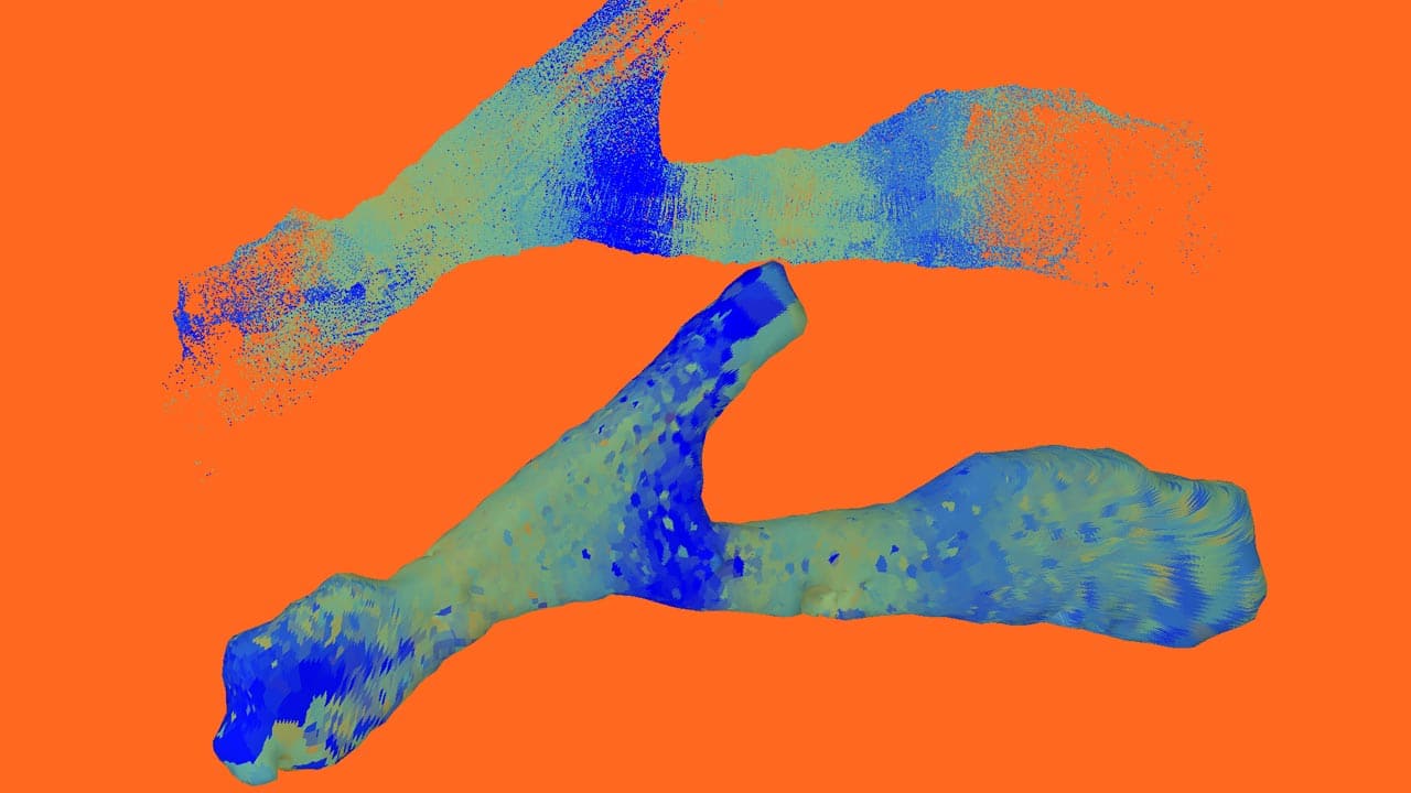
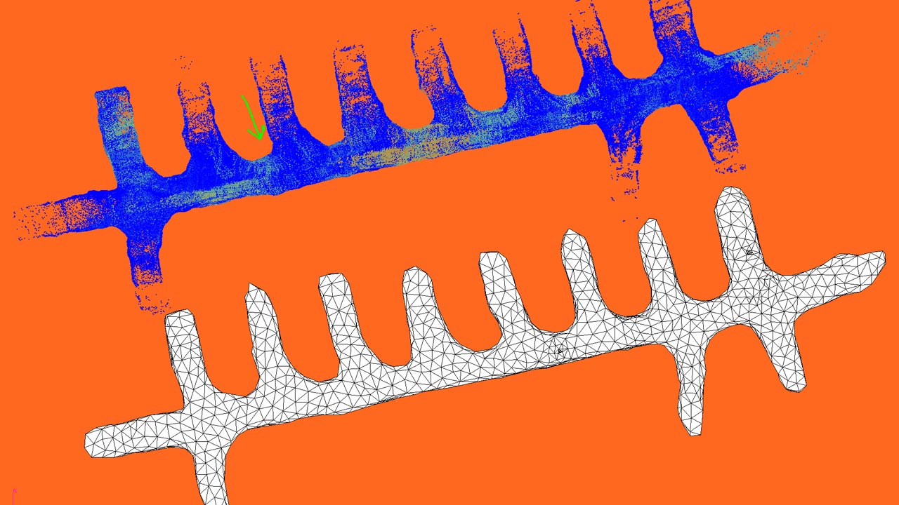
Turns point clouds into high quality surfaces
Turns point clouds into high quality surfaces or water tight solids that honor the original points.
Mesh repairing tools
Mesh repairing tools including hole filling and mesh solidification.
Easy to use modelling and CAD tools
Easy to use modelling and CAD tools for underground survey applications, including cross sectioning, volume and surface area calculations.
Robust and powerful mesh cutter
Cuts a Mesh by plane, polygon or another mesh.
Creates arbitrary cross sections from a mesh.
Robust mesh Boolean operations (intersection, union, difference and symmetric differences)
Includes reconciliation tools
Includes reconciliation tools to show design variance, areas of conformance, and underdig and overdig.
System Requirements:
CPU: Quad Core
RAM: 8gb
HARD DRIVE: 500gb SSD
VIDEO CARD: 1gb VRAM
CPU: 3rd Gen Ryzen 5/7 or Intel i7
RAM: 16gb
HARD DRIVE: 1tb SSD
VIDEO CARD: 2gb VRAM
Our mission is to empower our clients to turn data into insights, respond to project changes quickly, and improve efficiency, profitability, and sustainability.
Office Phone: +1-613-454-5327
Toll Free in North America: +1-855-760-4063